July18 at EveryTrail
Map created by EveryTrail: GPS Trip Sharing with Google Maps
116 KMs Trip meter 17124 KMs
Finally heading out of Leh after chilling out for 3 days. With Diskit just 110 kms, it got me pretty lazy. Thought of doing a quick blog update for the last couple of days, the pc at the cyber cafe troubled me into delay. Was like 11.30 when i started. The hotel owner said that i was late cos the army convoy comes by the time i go and i will be troubled! Today is again a cloudy day and kinda not very impressing. Heading towards the Highest Motorable road in the world! K-top! The climb starts soon after exiting Leh, and it just keeps on going up. The huge mountains ridges which i ride on looks like a small mound after some time. I can still see Leh city. The roads are good and ride is going on smooth. Just that with cloudy weather, photographs may not come so good. See a lot of bikers this time. The most i have seen in this trip. Mostly bullets and foreigners. Met a group of bullters from Bangalore. Looks like i am not in a hurry. After south pallu the road starts to deteriorate. The distant line on the mountains is what i will be riding on some time later. But i can still see Leh city! As its gets highers the road worsens. Even after like 35 kms i can still see Leh city and make out the Shanthi stupa. K-top is on top of a mountain ridge just next to Leh! Now riding at the white tops of the mountains and lots of snow melt stream crossing todo. Around a km to Leh, where the road gets real narrow, the army is rolling down. I park myself on one of the extensions made. The army trucks keep coming on one by one. Had i made it to k-top before this, atleast i could have had some food. But as assured by a worker nearby, the convoy had passed withing like 15 mins. Now i am free to go. In no time i am at k-top posing for the photograph with the k-top board! Yup i made it, after seeing n number of similar pix done by bikers over the years. It was bit windy and cold out there. Having some biscuits and tea time to move on.
The other side was more white. Even saw ice stalactites on the side, Cant expect bettor road until North pallu some KMs away. After some riding between ice fence, its back tot he brown area. Get to North pallu and restaurants were not convenient to watch over the bike. so i ride ahead towards khardung for the food. Was hungry btw. The landscape was all dry now and it was completely different environment. Took a couple of breaks looking around. Had much needed maggie at khardung village. Its again going down then on. Lot of open spaces and rocks come in all colours. Cam just cannot catch the dept of the place.
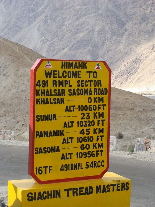
Before reaching Khalsar, saw a nice road going towards Aghyam village. Guess thats the one to take on the return if i am riding on Wari la. But lets see. After a few kms from Khalsar village there is a fork the straight one going towards panamic and the left one going towards Diskit. Its 15 kms from here. So i am in good time. The moment i take the left turn i am riding on flat road with desert sand on either sand. It was fun. After a few kms its back to the wall riding for few kms and i make it to Diskit. See a few guest houses couple of kms before Diskit, but prefered at center of the town in case i need some thing. Find a nice one at Sand dune guest house with private parking and reasonable price so i checkin. Pretty early in the day. So just laze around for the rest of the day.
Map created by EveryTrail: GPS Trip Sharing with Google Maps
116 KMs Trip meter 17124 KMs
Finally heading out of Leh after chilling out for 3 days. With Diskit just 110 kms, it got me pretty lazy. Thought of doing a quick blog update for the last couple of days, the pc at the cyber cafe troubled me into delay. Was like 11.30 when i started. The hotel owner said that i was late cos the army convoy comes by the time i go and i will be troubled! Today is again a cloudy day and kinda not very impressing. Heading towards the Highest Motorable road in the world! K-top! The climb starts soon after exiting Leh, and it just keeps on going up. The huge mountains ridges which i ride on looks like a small mound after some time. I can still see Leh city. The roads are good and ride is going on smooth. Just that with cloudy weather, photographs may not come so good. See a lot of bikers this time. The most i have seen in this trip. Mostly bullets and foreigners. Met a group of bullters from Bangalore. Looks like i am not in a hurry. After south pallu the road starts to deteriorate. The distant line on the mountains is what i will be riding on some time later. But i can still see Leh city! As its gets highers the road worsens. Even after like 35 kms i can still see Leh city and make out the Shanthi stupa. K-top is on top of a mountain ridge just next to Leh! Now riding at the white tops of the mountains and lots of snow melt stream crossing todo. Around a km to Leh, where the road gets real narrow, the army is rolling down. I park myself on one of the extensions made. The army trucks keep coming on one by one. Had i made it to k-top before this, atleast i could have had some food. But as assured by a worker nearby, the convoy had passed withing like 15 mins. Now i am free to go. In no time i am at k-top posing for the photograph with the k-top board! Yup i made it, after seeing n number of similar pix done by bikers over the years. It was bit windy and cold out there. Having some biscuits and tea time to move on.
The other side was more white. Even saw ice stalactites on the side, Cant expect bettor road until North pallu some KMs away. After some riding between ice fence, its back tot he brown area. Get to North pallu and restaurants were not convenient to watch over the bike. so i ride ahead towards khardung for the food. Was hungry btw. The landscape was all dry now and it was completely different environment. Took a couple of breaks looking around. Had much needed maggie at khardung village. Its again going down then on. Lot of open spaces and rocks come in all colours. Cam just cannot catch the dept of the place.
Before reaching Khalsar, saw a nice road going towards Aghyam village. Guess thats the one to take on the return if i am riding on Wari la. But lets see. After a few kms from Khalsar village there is a fork the straight one going towards panamic and the left one going towards Diskit. Its 15 kms from here. So i am in good time. The moment i take the left turn i am riding on flat road with desert sand on either sand. It was fun. After a few kms its back to the wall riding for few kms and i make it to Diskit. See a few guest houses couple of kms before Diskit, but prefered at center of the town in case i need some thing. Find a nice one at Sand dune guest house with private parking and reasonable price so i checkin. Pretty early in the day. So just laze around for the rest of the day.
These guys fed me for 3 days. Forgot their full names but both are S Singh.

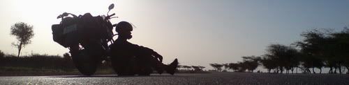
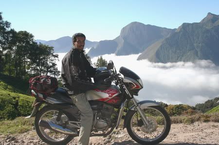
Heading out of Leh....
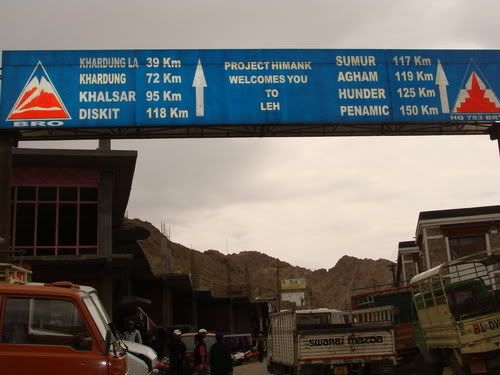
The board says it all....
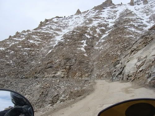
The road just climbs and climbs....
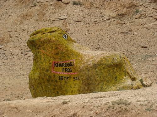
KhardungLa frog?!!

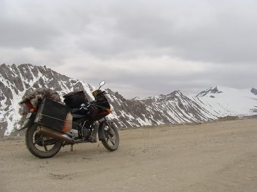
Going up but can still see Leh...

Couple of sumos with the Drive up, ride down company....

Are these Road runners? cos all they do is run on the road....


Getting near to the white top...

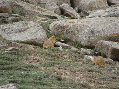
More marmots spotted...
Road to offroad nearing the top...

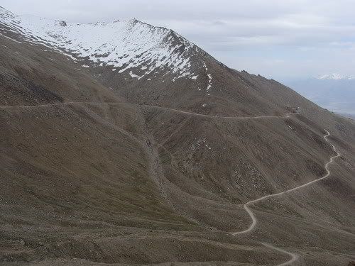
34 KMs and i can still see Leh!!


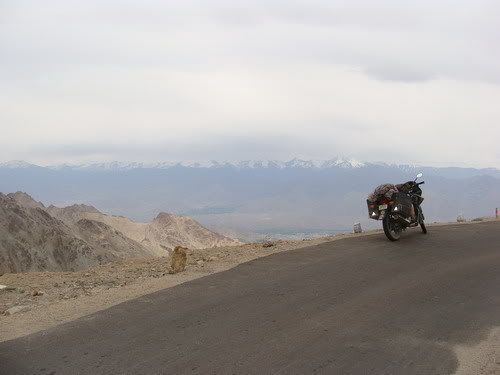
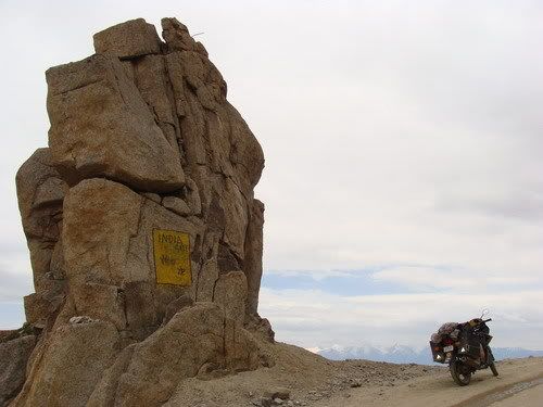
Bike at the India gate....

Long climb is done...
Natural stone henge...

Riding above the snow line...
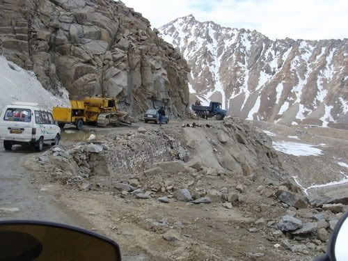
Have to wait out the Military covoy followed by the truckies...

Yes my bike makes it!

I made it tooo!

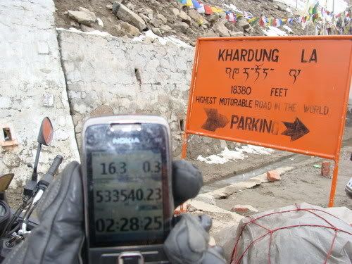
But the fone says 17605 feet! But then it was cloudy and gps gets affected?
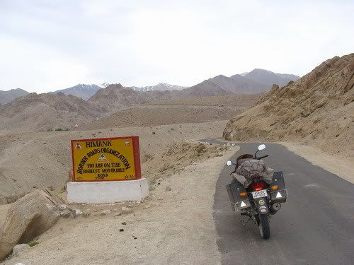
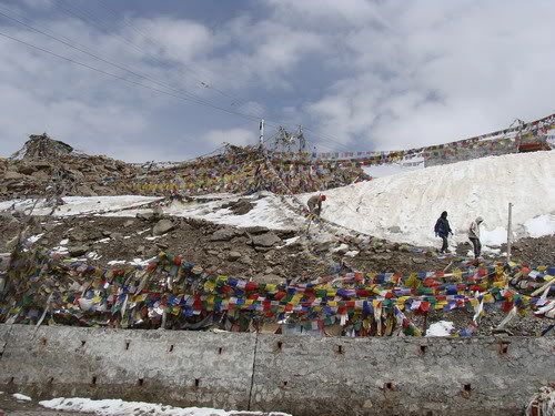
Lot of boards saying that...
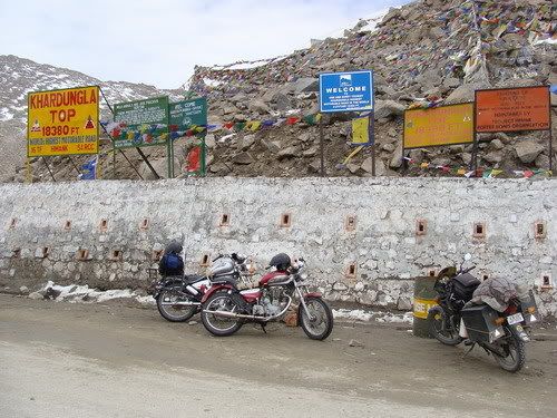
At the top...

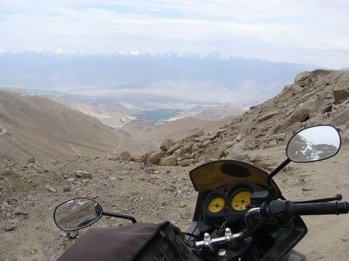
The side i came from....
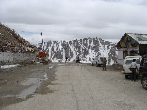
The Gonpa above...

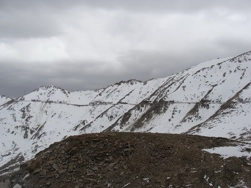
Lot more snow on the other side....

Plenty more...

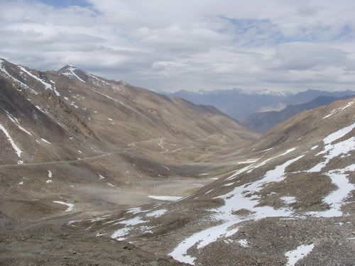
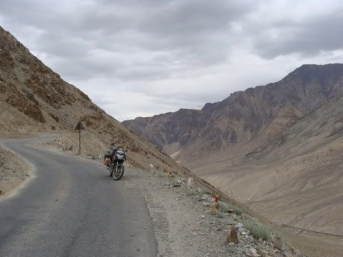
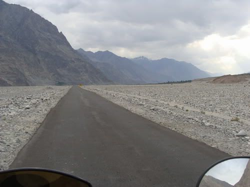
Winding road going down to Nubra valley....
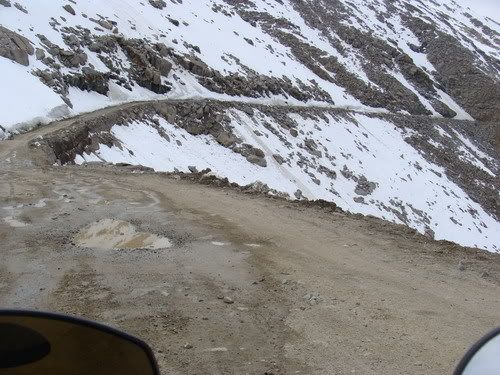
Some ride along the snow...

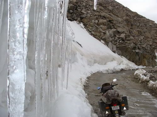
Icicles!

A road block which i rode around....
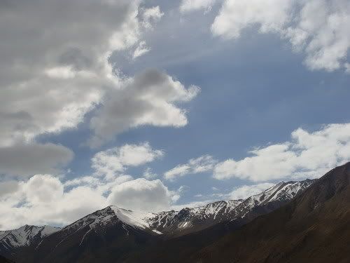
Came down from there but the sky not so friendly...

A half frozen lake...

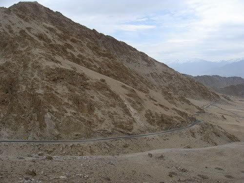
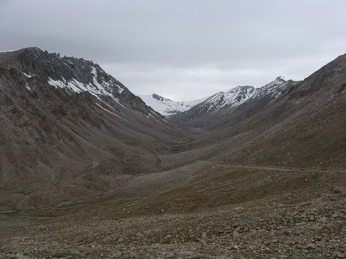
Going down....The lowest point in the center is the k-top


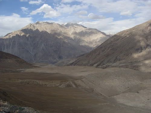
Back to the browns....
Some rare greenary...
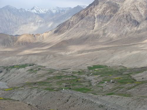
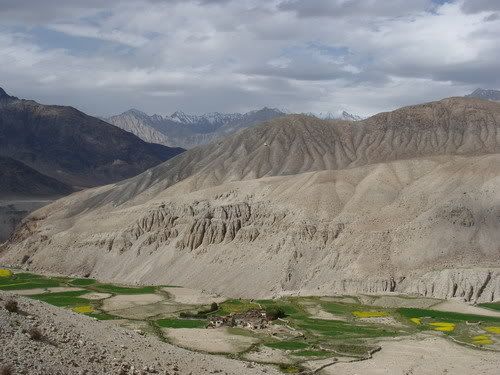
A private valley!
The Khardung Village...

They actually form the flowers?

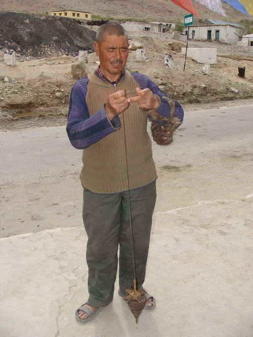
A resident making yarn out of yak wool....
Had my fill here...

A happy local resident...

Leaving behind k-top and Khardung village....

More dramatic change in landscape...

Loved the break here....

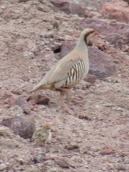
Road runner(?) with a chick...

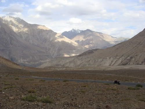
The way i have to take if i wanna scale WariLa
Some made up path...
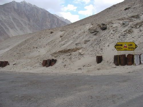
The fork to the two vallies in Nobra...

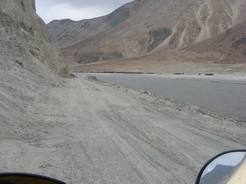
Some ride on river bed road...


Make it to Diskit...

Some community gathering place i guess...

Sleepy town...

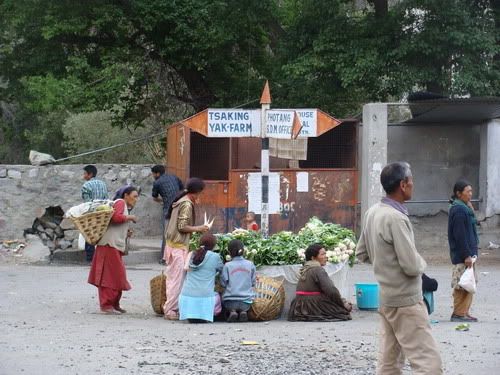
Sign post doubles up as market!
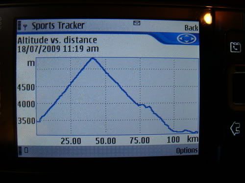
Vertical travel for the day....
Heading out of Leh....
The board says it all....
The road just climbs and climbs....
KhardungLa frog?!!
Going up but can still see Leh...
Couple of sumos with the Drive up, ride down company....
Are these Road runners? cos all they do is run on the road....
Getting near to the white top...
More marmots spotted...
Road to offroad nearing the top...
34 KMs and i can still see Leh!!
Bike at the India gate....
Long climb is done...
Natural stone henge...
Riding above the snow line...
Have to wait out the Military covoy followed by the truckies...
Yes my bike makes it!
I made it tooo!
But the fone says 17605 feet! But then it was cloudy and gps gets affected?
Lot of boards saying that...
At the top...
The side i came from....
The Gonpa above...
Lot more snow on the other side....
Plenty more...
Winding road going down to Nubra valley....
Some ride along the snow...
Icicles!
A road block which i rode around....
Came down from there but the sky not so friendly...
A half frozen lake...
Going down....The lowest point in the center is the k-top
Back to the browns....
Some rare greenary...
A private valley!
The Khardung Village...
They actually form the flowers?
A resident making yarn out of yak wool....
Had my fill here...
A happy local resident...
Leaving behind k-top and Khardung village....
More dramatic change in landscape...
Loved the break here....
Road runner(?) with a chick...
The way i have to take if i wanna scale WariLa
Some made up path...
The fork to the two vallies in Nobra...
Some ride on river bed road...
Make it to Diskit...
Some community gathering place i guess...
Sleepy town...
Sign post doubles up as market!
Vertical travel for the day....
4 comments:
congrats on reaching the worlds highest motorable road : )
congrats on reaching the worlds highest motorable road : )
AWESOME !!! FANTABULOUS !!! FANTASTIC !!! Super!! I mean all the superlatives for this man! and you doing it alone!! waah! U must be on TV next ! for this...
Thanks Mani. Its highest on paper but my fone does not say so :)
Hehe thanks Alok :)
Post a Comment